Profile & expertise

Founded in 1737, the University of Goettingen is a research university of international renown with strong focuses in research-led teaching. The University is distinguished by the rich diversity of its subject spectrum, particularly in the humanities, and its excellent facilities for the pursuit of scientific research. At the beginning of 2003, the University of Goettingen became the first German university with a comprehensive range of disciplines to assume the legal status of a foundation under public law. The University has since then enhanced its research profile, created new research entities such as the Courant Research Centres and the Lichtenberg-Kolleg, intensified cooperation on the Goettingen Campus, attracted and retained outstanding academics and supported the recruitment of excellent students and young academics from abroad. The University is founding member of the Coimbra Group and the U4 Network and is running active agreements with institutions of higher education in ninety countries.

There is a strong technical and scientific cooperation with the Digital Library Department of the Göttingen State- and University Library (SUB) in terms of geospatial data analysis and research software engineering.

Role in the Project

UGOE will support UEG for Göttingen site work and will lead the mapping of the geological contexts and the most promising sites.

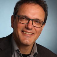
Dr. Bernd Leiss: Structural geologist (GZG); Ph.D at the University of Goettingen. Expertise: focus on quantitative micro fabric analysis related to deformation history and petrophysics, field experience in different structural crustal levels. Founded in 2007 a study group to develop a first concept on the exploration of the Geothermal potential of the Göttingen region. As a scientific project coordinator and as consultant now also employed by the “Universitätsenergie Göttingen GmbH” to implement the geothermal concept for the Göttingen campus (e.g. 2D-seismic exploration). Ongoing structural analysis of the analogue area “Harz-mountains”.

Leiss_Bernd_Foto_UEG-UGOE

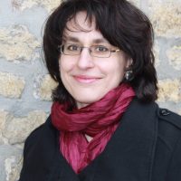
Bianca Wagner is a senior research scientist at the Department of Structural Geology and Geodynamics of the Geoscience Centre of the University in Göttingen. She studied Geology/Palaeontology at the University of Resources in Freiberg and at the University of Göttingen, where she achieved her PhD in the field of GIS-based analysis of Cenozoic geodynamics and mineralization of NW Yunnan (P.R. of China) in 2003. In 2008 she accomplished the degree “Public Relation Consultant (DAPR)” at the University of Management and Communication (Technical College) in Potsdam.

She has a strong methodological background in spatial data analysis, as her previous research focused on the application of Geographic Information Systems, Remote Sensing techniques and 3D Modelling to investigate geological, geotechnical, hydrogeological and hydrological research questions in Europe, in Asia and in the Middle East.

For some years now, Bianca Wagner has been extending her field work and research methods by incorporating surface and subsurface 3D field surveying techniques (digital photogrammetry, terrestrial laser scanning) and 3D modelling at outcrop-scale.

At the same time, she has been deepening her expertise in the fields of public relation, research data management, graphic recording & sketching, project management and concept development.

Within the past years, her research emphasis had been shifting to the exploration of the shallow, medium and deep geothermal potential of the Göttingen region. Therefore, her recent research focuses on the acquisition, homogenization, storage, analysis and interpretation of geospatial data that is relevant for geothermal energy usage. As one of the geothermal project coordinators, since 2018 she has been employed in part-time at the Universitätsenergie Göttingen GmbH.

Wagner_Bianca_UEG_UGOE

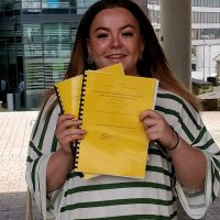
Katherine Ford is a PhD student at the University of Göttingen in the Department of Structural Geology and Geodynamics, and has been so since August of 2018. She qualified for a Master of Geology with Honours from the University of Plymouth, UK, in September 2018. The focus of her master thesis was in fracture network characterisation using high resolution drone imagery and its implications for the geothermal industry. Her current work focuses on the creation of a 3D structural and conceptual model of the Variscan basement underlying Göttingen. This work will involve the collection of field data and samples from the Western Harz Mountains to analyse the variation in structural parameters across a typical Variscan fold and thrust structure. This will include the analysis of the fracture network, changes in the lithology and mineralisation across varying scales, from reservoir down to microscale.

katie ford_UGOE

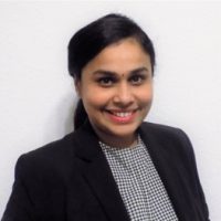
Richu Mary Shelly is working as a Geospatial Analyst in Georg-August-Universität, Göttingen. She completed her Masters in Geodesy and Geoinformatics from Leibniz Universität, Hannover. She also holds a Masters degree in Computer Science and Engineering from Kannur University, Kerala, India. During her Master thesis and studies, she has focused mainly on the analysis and visualisation of geospatial data using Machine Learning and GIS technologies. She was also part of a team that developed Leibniznav, an indoor navigation system for Leibniz Universität as a project during her postgraduate studies. As a participant of Erasmus+ study exchange program, she also completed a semester in Newcastle University, UK wherein the subject ares included Applied Geospatial Data Handling, Spatial Data Modelling, Geospatial Informatics etc. Within the MEET project, she is developing a web map viewer which would enable the visulaization of the surface and subsurface aspects related to Geothermal Energy at a European Scale. This includes obtaining, preprocessing and utilizing geodata from a wide variety of sources which extends from demosites to Europe as a whole. This webtool will serve as a guide and would enable the users to identify the best potential sites/areas for Geothermal Energy in Europe.

photo_richu